Inwangsan (인왕산) is one of the easiest Seoul mountains to fit into a normal day. The summit is about 30 minutes from the tiger statue trailhead, the trail runs alongside the original Seoul Fortress Wall (한양도성) from the Joseon dynasty, and the view from the top wraps around almost every Seoul landmark you can name — N Seoul Tower, the palace grounds, the Blue House, Lotte World Tower, all visible from one spot. If you only have a couple of hours and you want a hike that actually shows you Seoul, this is the one.
I did this on a clear Sunday in May — started around 1pm after lunch, more on a whim than as a plan. Inwangsan is about ten minutes by subway from central Seoul, the summit is roughly 30 minutes from the trailhead, and you can be back at the gates of Gyeongbokgung Palace by mid-afternoon. The mountain has been there since the Joseon dynasty, walling off the palace to the west, and that history shows up the moment you start walking the ridge.
Getting there and the parking situation nobody warns you about
I drove this time, but the easiest way to get here without a car is the subway. Starting point is Gyeongbokgung Station (경복궁역) on Line 3, Exit 1 — from there it’s a 20-30 minute walk to the tiger statue trailhead.
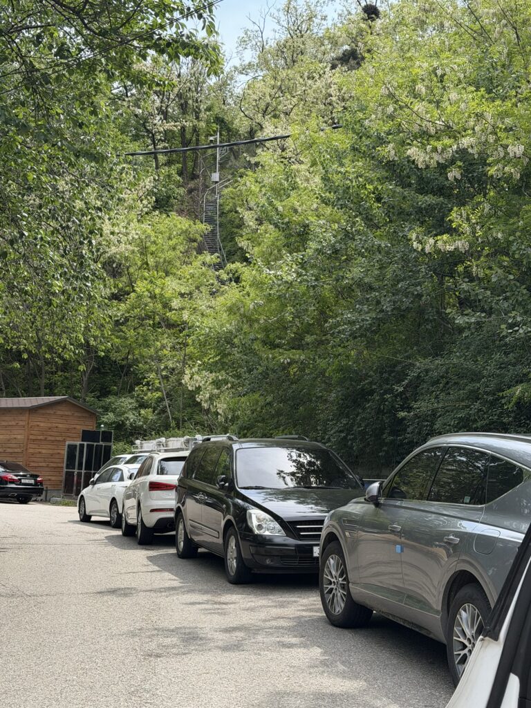
If you’re driving: there’s parking near the tiger statue, but it’s not a formal lot — cars pull over on the roadside along the approach road. We got there around 1pm on a Sunday and almost everything was taken, but we got lucky with one spot opening up just as we pulled in. If you can come outside of peak hours, easier. Otherwise, plan for a little circling.
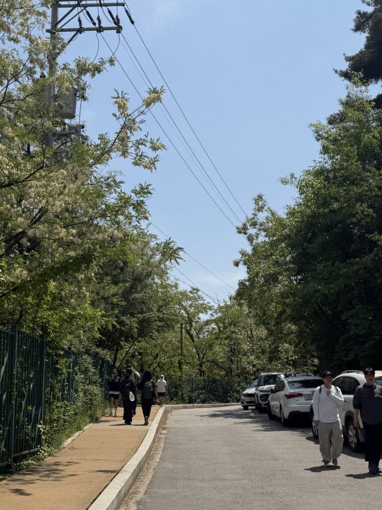
Even before the trail starts, the approach is green — mid-May leaves all the way out, that air that smells like spring. Nothing to stop and photograph, but the kind of afternoon that reminds you why you left the apartment.

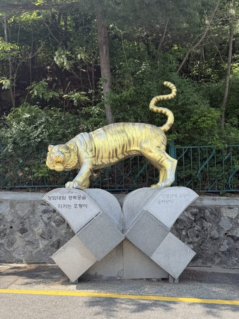
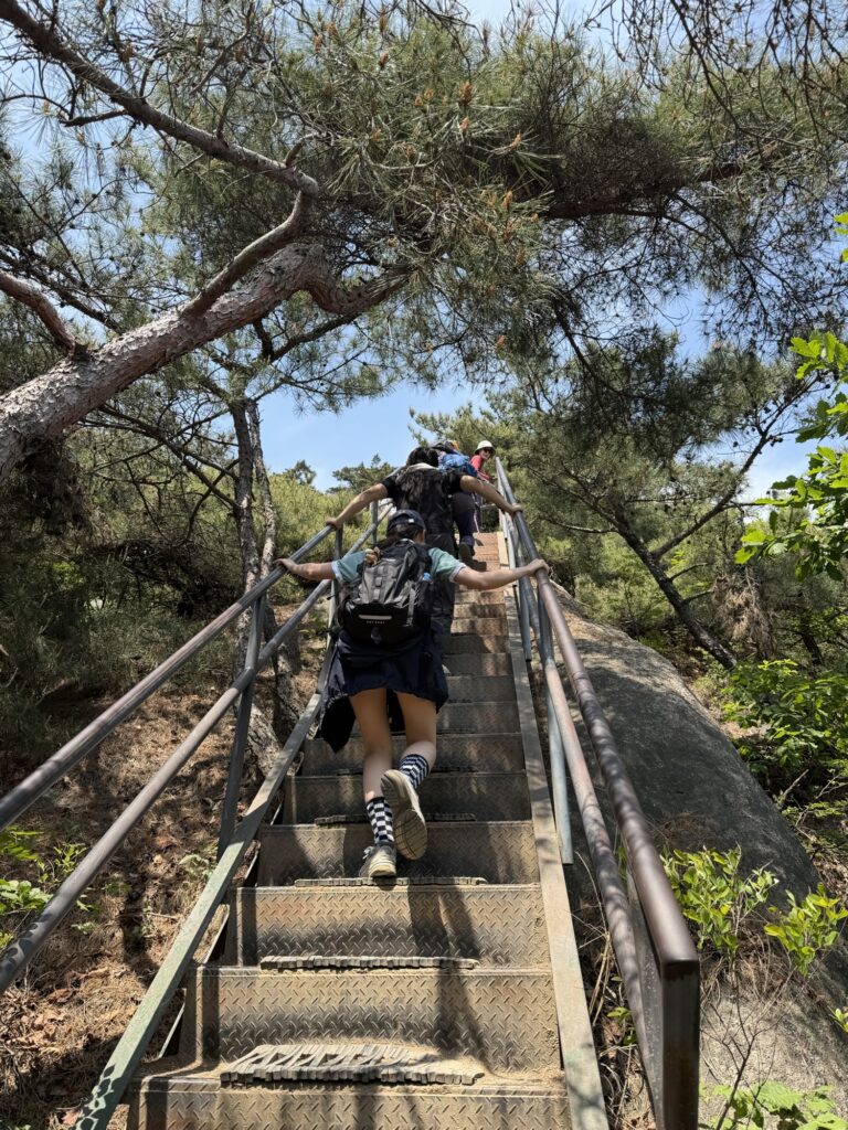
I almost walked past it. The actual trail entrance is easy to miss if you’re not watching for it — walking along the road toward the tiger statue, you’ll see a set of metal steps on the right with a gate and a red-bordered sign in Korean. That’s it — that’s the start. There’s also a NO FLY ZONE notice posted here (the mountain has military installations, so drone flights are prohibited).
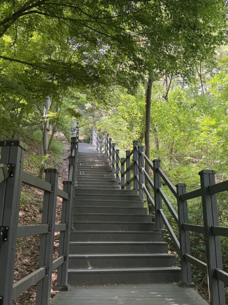
The opening section is stone stairs. A lot of stone stairs. They start steep and stay steep. I charged the first flight and immediately regretted it. The pace you set in the first five minutes determines how your legs feel at the top — take it steady, especially if it’s warm out.
The fake summit

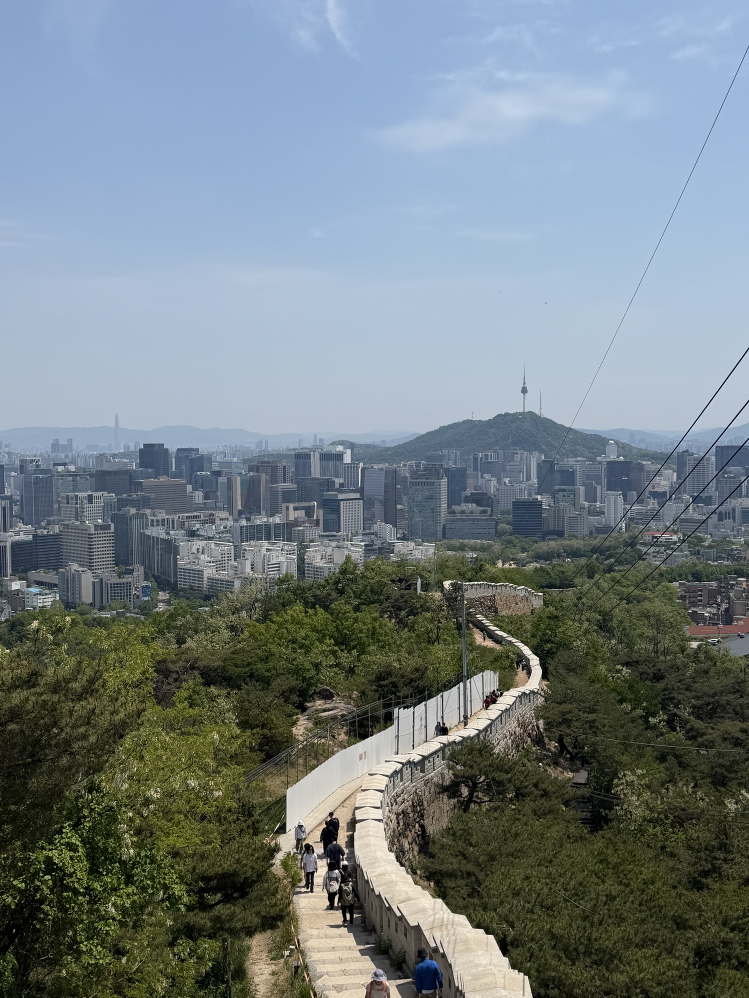
After a few minutes of stairs, the view opens up. Other Seoul mountains tend to be forested — you walk inside a tunnel of trees and can’t really see ahead. Inwangsan is the opposite. You can see the trail unfold up the ridge — granite, fortress wall, sky — which I found unexpectedly fun. And that peak above you? It looks like the summit, but it’s not. It’s a false top — the first rocky dome on the ridge. The actual summit is one more push past a flat saddle and up a second, slightly steeper section.
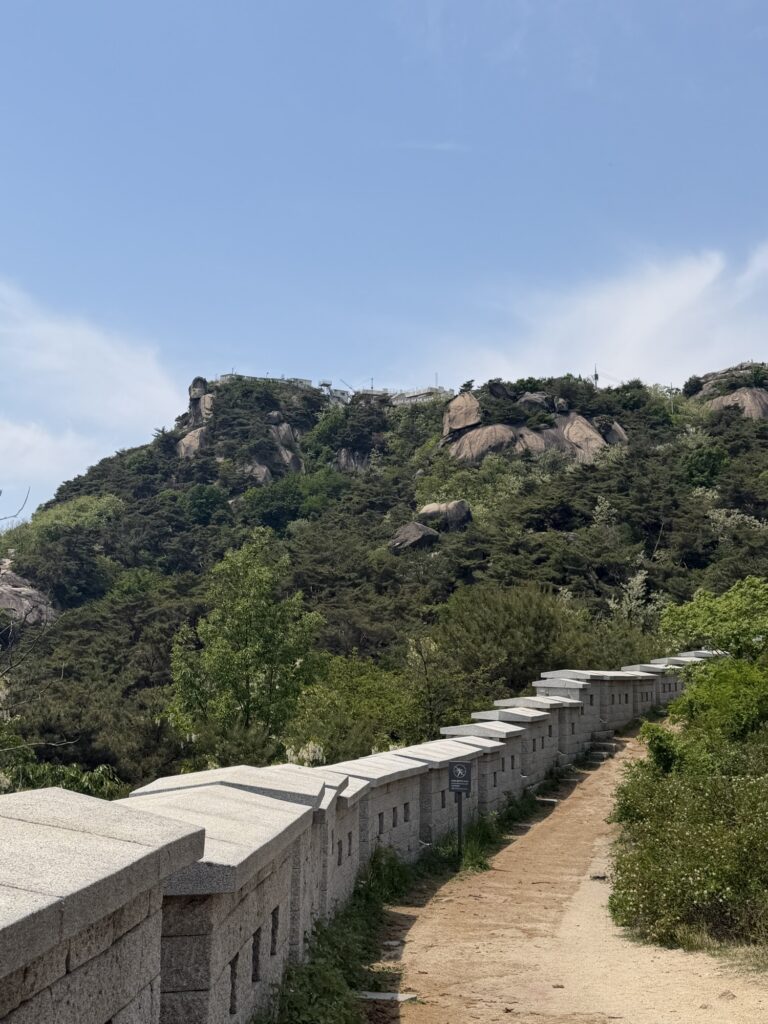
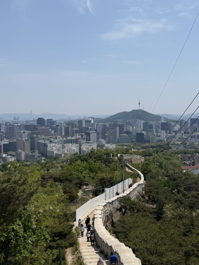
The Seoul Fortress Wall runs right alongside the trail through this section. The stone is pale granite, low-walled, no railing on the wall itself — just the path and the fortification side by side. The 성곽길 (fortress wall path) is, I think, the thing that sticks with you most after you’ve done this trail. It doesn’t feel like a hiking trail; it feels like you’re walking the perimeter of something old, because you are.
The second push — steeper, rockier, worth it
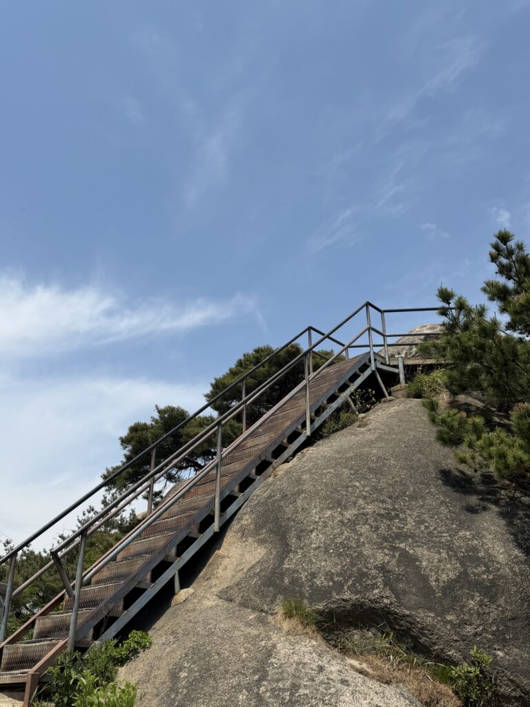
Past the metal staircase, the real climb to the summit begins. The steps are more irregular — actual rock, not cut stone — and the grade is a bit sharper. Nothing technical, but you’ll feel it.
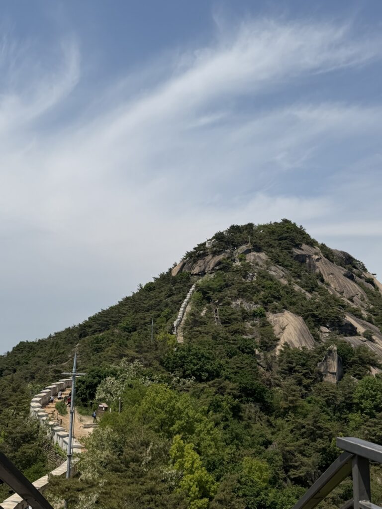
From here you can see the actual top clearly. It’s another peak-looking dome of bare granite, the same distance and vertical gain as the first one. If you made it up the first section without stopping, you’ll make it up this one.
Same stair-and-wall combination as the lower section, but the steps are steeper here. Watch your footing. Gripped trail shoes help — regular sneakers are fine, but anything with zero traction is asking for trouble.

Near the very top, the trail narrows to single file — barely enough room for two people. If someone is coming down, you wait. It does mean the last 50 meters can take longer than expected depending on the traffic flow.
At the top — about 30 minutes in, and worth every stair
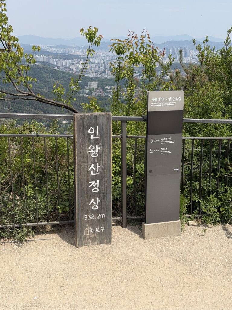
The summit marker stone is there, and I queued for maybe five minutes to get a photo. On a popular weekend it’s probably longer. Most people treat it as a quick stop — snap the photo, take in the view, move on.
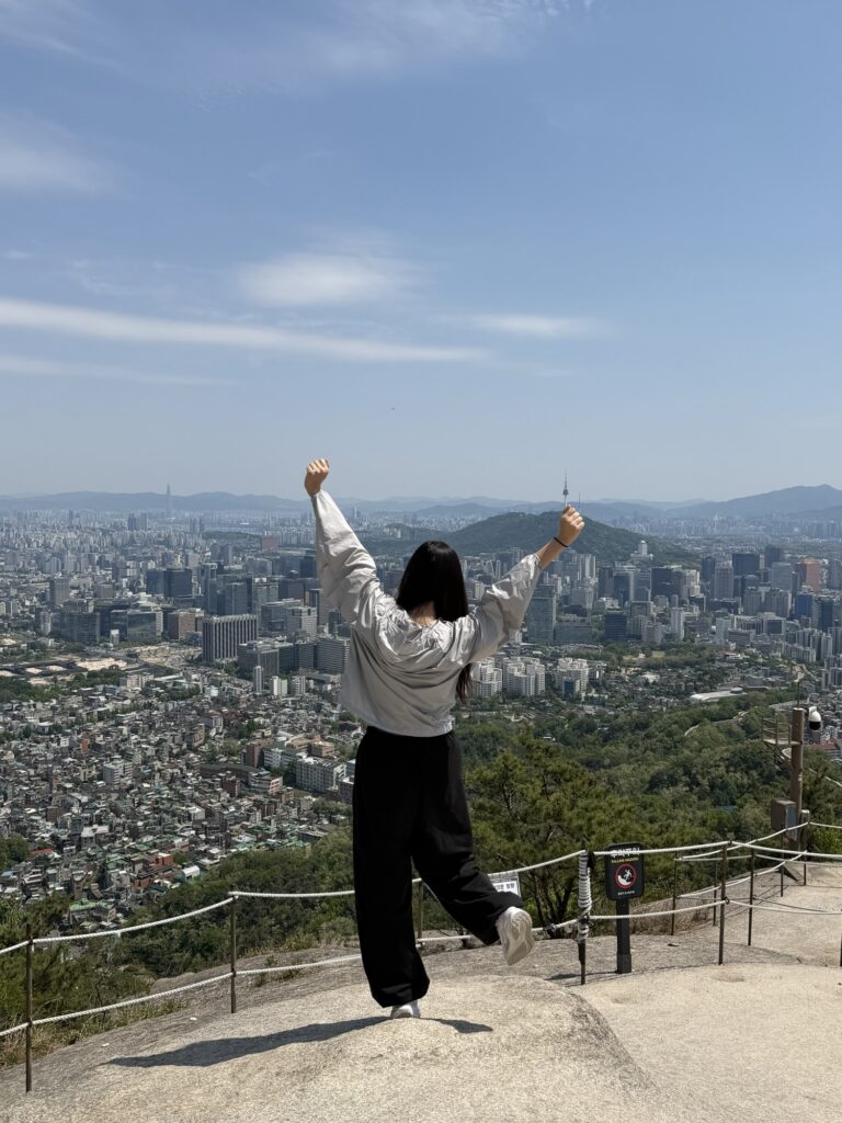
The view from the top is genuinely one of the better ones in Seoul for sheer density of landmarks. Looking out from 338 meters inside the city, you can see N Seoul Tower (남산) to the south, 63 Building and Lotte World Tower in the distance, Gyeongbokgung Palace grounds and the old Blue House (청와대) directly below to the east. The city was wrapped around me in every direction. That feeling of your chest opening up that people talk about — it’s a lot of Seoul at once, and it takes a moment to take in.
The descent is the same path back down. On the way up I was watching my feet. On the way down I was watching the view. The wind picks up on the exposed ridge sections on the descent, which after sweating through the stairs feels exactly right. Give yourself 20-25 minutes back to the trailhead.
The yogurt ajumma — if you’re lucky

At the trailhead exit there was a 요구르트 ajumma — women who roll around Korea on motorized carts full of small Yakult-style yogurt drinks. You’ll see them by parks, subway exits, residential blocks — it’s basically a delivery system on wheels. One cold bottle does an unreasonably good job of cutting post-hike thirst in a single sip. She’s not there every day, so spotting one feels like a small bit of luck. You buy one and drink it in one go. Cold, a little sweet, nothing complicated. The kind of small thing that makes the end of a hike feel like an actual ending.
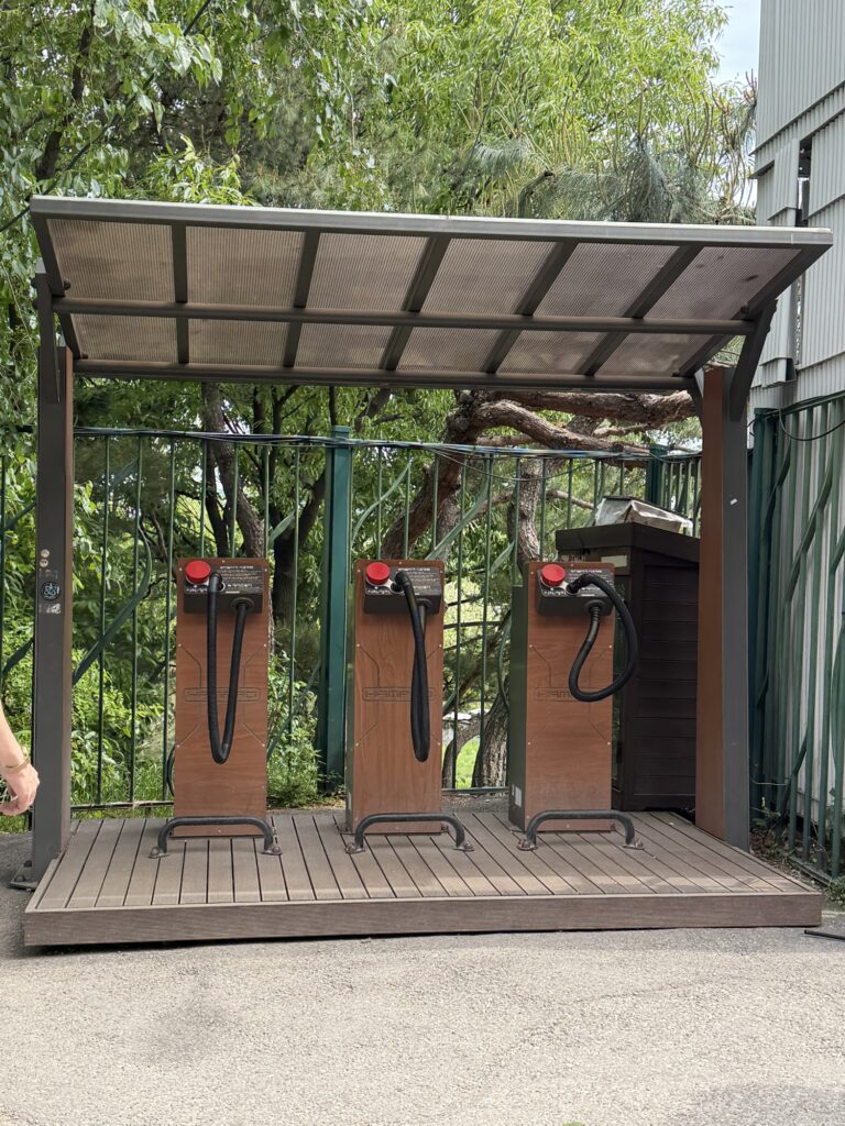
Three upright machines sit under a roof shelter at the trailhead exit — compressed air nozzles on rubber hoses, red control buttons. These are shoe and clothing dust blowers, free to use. Point the nozzle at your shoes and jacket, press the button. In Korea, blowing the trail dust off at the bottom is basically how you officially finish a hike — your hike isn’t really done until you’ve used one of these. Worth the thirty seconds, especially before heading into a coffee shop or back onto the subway.
Quick notes before you go
Subway: Line 3 Gyeongbokgung Station, Exit 1. About 20-30 minutes walk to the trailhead.
By car: roadside parking near tiger statue trailhead — not a formal lot, fills up by mid-morning on weekends.
Summit time: 25-35 minutes from the trailhead for most people. Round trip under an hour.
Difficulty: Easy-to-moderate. Long stairs, rocky near the top, single-file section near the summit. Regular fitness handles this without trouble.
Bring: Water (nothing available on trail), sunscreen (the ridge is fully exposed), comfortable closed-toe shoes.
After: Seochon neighborhood (서촌) is a five-minute walk from the trailhead area — good cafes, a calmer version of Bukchon. Tongin Market (통인시장) is nearby if you want lunch.
Season: Spring (April-May) and autumn (October-November) are the obvious choices. Summer gets humid and the exposed ridge is merciless in July heat. Winter is fine if the rock is dry — the granite gets slippery when wet or icy.
No drones: this is a no-fly zone, and there’s an active military installation on the ridge.
Where to find the trailhead
Inwangsan Tiger Statue Trailhead (인왕산 호랑이 동상)
Seoul, Jongno-gu, Nusang-dong San 1-27 (서울특별시 종로구 누상동 산1-27)
Gyeongbokgung Station (Line 3), Exit 1 — about 20-30 minutes walk.
Open access, no entrance fee.
Last verified: May 11, 2026.
Leave a Reply